

Mars Xplorer

Perihal Mars Xplorer
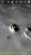
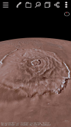
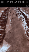
Join the fun! This application lets you view the terrain of the planet mars in 3D. Data from NASA and USGS combined with Deep Learning Artificial Intelligence Swarm works together to give you the best real experience and extend your smart phone capabilities. The AI is new and can detect structures on the surface. The default color layer shown is 323m/pixel but there is a higher resolution radar grey 100m/pixel. It allows you to zoom down to the surface and roam around like a rover. You can fly over interesting areas using our "Trek" capability. You can quickly create your own custom Treks anywhere on Mars fly over them and save them for use anytime! You can select one of our GPS Tracks or add your own then fly over automatically using that track selecting your altitude and rate. Lists of locations on the planet are available from us or you enter and zoom to the longitude/latitude you enter. Multiple layers of terrain information can be overlapped and transparency control for each layer is provided.
It is best to use an internet connection through a WiFi router and we tested with 2GB of CPU Memory and large pixel count but it might be okay with 1GB and low pixel resolution but not with 500MB of CPU Memory. We support Android 5.1+.
Sertai keseronokan! Permohonan ini membolehkan anda melihat rupa bumi mars planet dalam 3D. Data daripada NASA dan USGS digabungkan dengan Deep Learning Artificial Intelligence Swarm bekerja bersama-sama untuk memberikan anda pengalaman sebenar yang terbaik dan memperluaskan keupayaan telefon pintar anda. AI yang baru dan boleh mengesan struktur di permukaan. Lapisan piawai yang ditunjukkan ialah 323m / pixel tetapi ada resolusi radar kelabu 100m / pixel yang lebih tinggi. Ia membolehkan anda untuk zum ke permukaan dan berkeliaran di sekitar seperti rover a. Anda boleh terbang di kawasan-kawasan yang menarik menggunakan keupayaan "Trek" kami. Anda dengan cepat boleh membuat Treks anda sendiri mana-mana sahaja di Marikh terbang di atas mereka dan menyelamatkan mereka untuk digunakan bila-bila masa! Anda boleh memilih salah satu daripada Tracks GPS kami atau menambah anda sendiri kemudian terbang ke atas secara automatik menggunakan trek memilih ketinggian dan kadar anda. Senarai lokasi di planet ini boleh didapati dari kami atau kamu masuk dan zum kepada longitud / latitud yang anda masukkan. Pelbagai lapisan maklumat rupa bumi boleh bertindih dan kawalan ketelusan untuk setiap lapisan disediakan.
Ia adalah terbaik untuk menggunakan sambungan internet melalui router WiFi dan kami diuji dengan 2GB memori CPU dan kiraan piksel besar tetapi ia mungkin baik-baik saja dengan 1GB dan resolusi pixel rendah tetapi tidak dengan 500MB CPU Memori. Kami menyokong Android 5.1+.


